Sea Chart
Offline nautical navigation app for Android. Download chart data for your region and navigate safely — even without internet at sea.
Get it on Google PlayApp Preview
Key Features
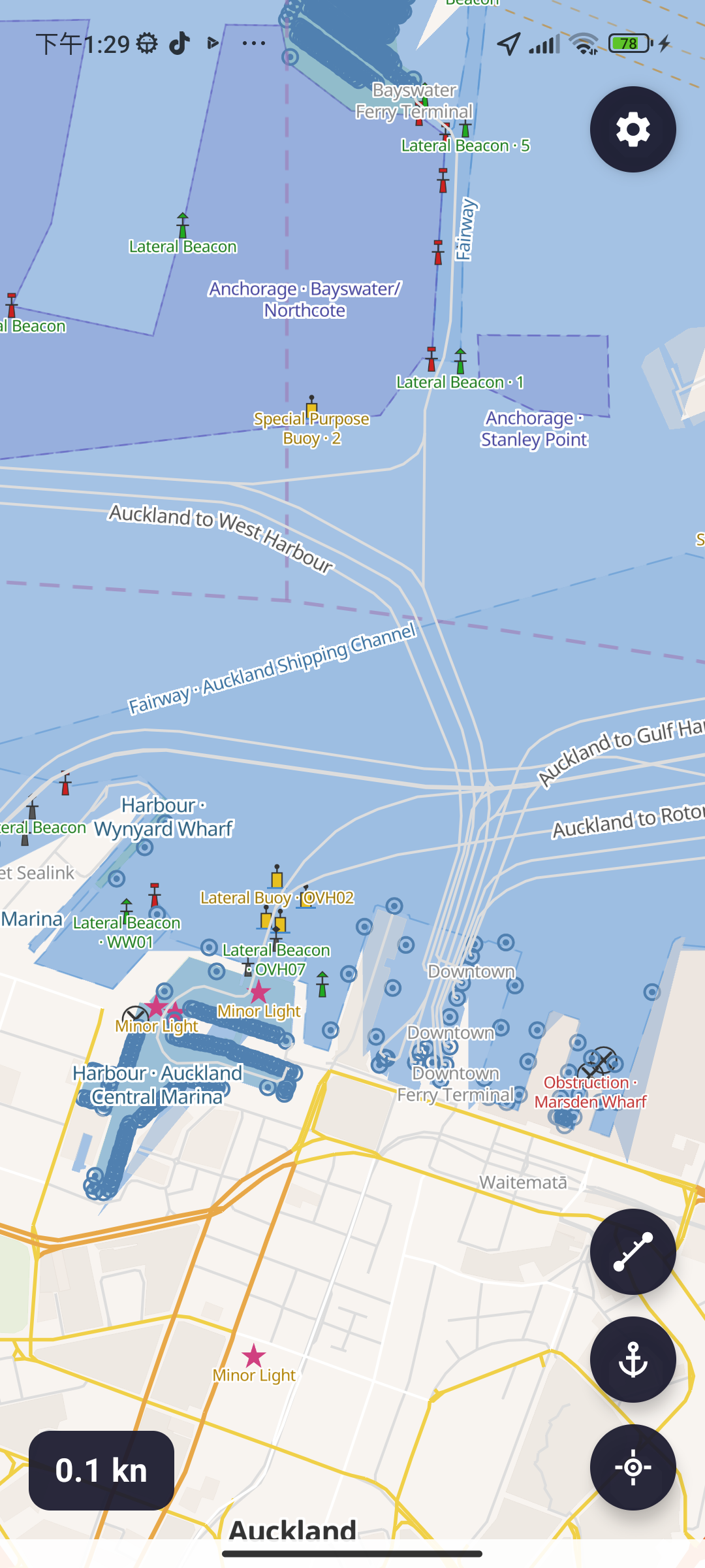
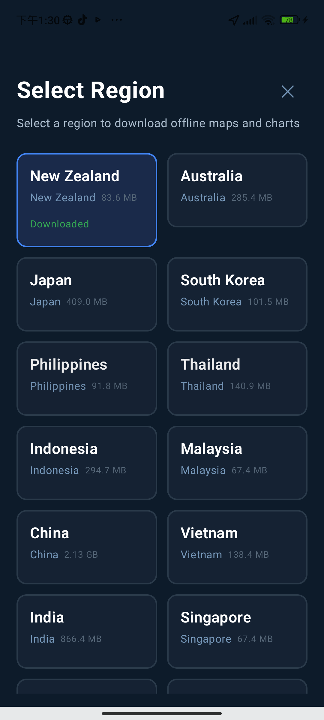
Offline Charts
Detailed nautical charts for 30+ countries. Download once, use anywhere — no internet needed at sea.
Anchor Watch
Set anchor position and radius. Get vibration and notification alerts if your vessel drifts beyond range.
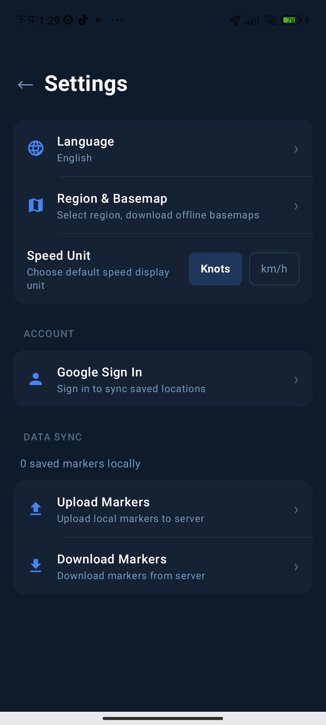
GPS Tracking
Real-time position and speed display. Switch between Knots and km/h to suit your preference.
Seamark Info
Tap any seamark to identify buoys, lighthouses, anchorages, fairways, restricted areas, and more.
Distance Measurement
Tap multiple waypoints on the chart to measure route distances for voyage planning.
Save Locations
Save favourite anchorages, berths, and points of interest locally or sync via Google account.
20+ Languages
Available in English, Chinese, Japanese, Korean, French, Spanish, Arabic, and many more.
Points of Interest
Find nearby harbours, marinas, fuel stations, restaurants, hospitals, and other facilities.
Supported Regions
Nautical charts covering 30+ countries and regions worldwide
Asia Pacific
Europe
Middle East
Americas & Africa
Coming Soon
Weather Data
Real-time marine weather forecasts including wind, wave height, and precipitation.
Route Navigation
Set a destination and get automatic route planning with turn-by-turn guidance.
Custom POI Markers
Add custom markers with notes on the map and share with other users.
Cloud Sync
Sign in with Google to sync saved locations across multiple devices.
Your Portable Nautical Assistant
Download Sea Chart and navigate safer voyages — completely offline.
Get it on Google Play