Offline nautical charts
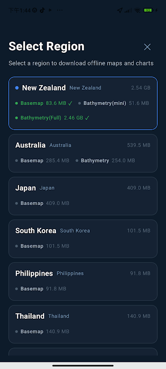
Download chart data for supported countries and regions before you leave, then continue viewing maps without an internet connection.
Marine navigation for Android
Sea Chart brings downloadable marine charts, live GPS, weather layers, depth information, route tools and anchor watch together in one Android app—ready for the moments when mobile coverage disappears.
Designed for life on the water
From planning a coastal trip to keeping watch at anchor, Sea Chart gives sailors, boaters and anglers the information they need in a clear mobile workspace.
Download chart data for supported countries and regions before you leave, then continue viewing maps without an internet connection.
Choose your anchor position and monitoring radius. Receive vibration and notification alerts when your vessel moves beyond the set range.
See your current position and sailing speed directly on the chart, with speed shown in knots or kilometres per hour.
Tap chart objects to identify buoys, lighthouses, anchorages, fairways, restricted areas, berths and other seamark types.
Place multiple points on the map and calculate the distance between them to support simple route and voyage planning.
Keep useful anchorages, berths and points of interest close at hand, and find nearby harbours, marinas, fuel and essential services.
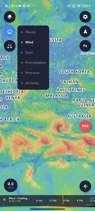
Explore visual weather layers for wind, gusts, waves, precipitation, pressure and air temperature, with a time control for changing conditions.
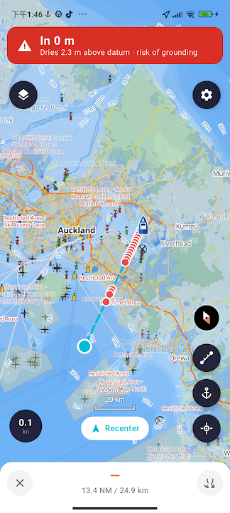
Create a route to your destination and follow the planned course on the nautical chart with distance information and live vessel position.
Add your own markers and notes to the map so fishing spots, hazards and useful places remain easy to find on future trips.
Sign in with Google to keep supported account data and saved locations available across your devices.
Inside the app
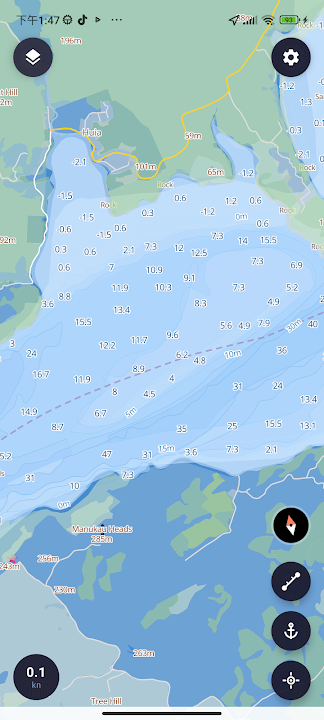
These current Google Play screenshots show route guidance, weather layers, detailed depths and downloadable chart regions inside Sea Chart.
Prepare before departure
Internet access can be unreliable near remote coastlines and offshore. Sea Chart lets you prepare regional chart data on land so essential map information remains available on your device.
Find the chart package for the coast or country you plan to visit.
Save the required data while you have a reliable connection.
Open downloaded maps and navigation tools when internet access is unavailable.
Made for real trips
Common questions
Yes. Download chart data for your region before departure, then open and use the downloaded charts while offline. GPS availability depends on your Android device and location.
You can view marine chart data and identify seamarks such as buoys, lighthouses, anchorages, fairways, restricted areas and berths by tapping them on the map.
Sea Chart includes Anchor Watch. Set an anchor position and monitoring radius, and the app can alert you if the vessel moves beyond that range, including while the app is running in the background.
Yes. Add multiple points on the chart to measure distances for simple voyage planning. You can also save frequently used places for later reference.
Sea Chart is available for Android from Google Play. Use the download button below to open the official app listing.
Ready for your next voyage?
Download the Android app, choose your chart region and prepare your device before leaving shore.
Get it on Google Play
